—Sylvester Loving, B1Daily
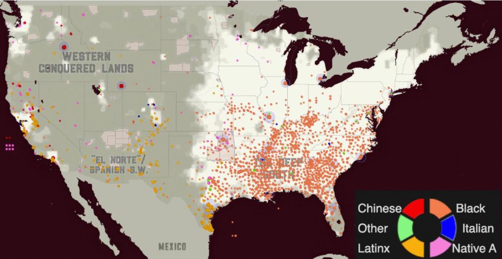
A map of the United States shouldn’t look this unsettling.
But visit Strange Fruit Map, and scattered across the country are markers representing Black people who have been found hanging since 2018.
Not statistics buried inside a spreadsheet.
Not forgotten headlines disappearing into Google’s basement.
Names. Places. Cases. Families.
The interactive project, associated with creator @BlackBeltBabe, describes its purpose plainly: documenting locations where Black people have been found hanging across the United States and making cases visible that might otherwise disappear from public attention.
And its existence raises a disturbing question:
How many of these deaths would most Americans even know about without someone deliberately putting them all in one place?
A Map That Forces You to Look
The power of Strange Fruit Map isn’t complicated.
Individual cases can easily become isolated local stories.
A Black person is found hanging in one state.
Another case happens hundreds of miles away.
Local police investigate.
A medical examiner reaches a conclusion.
The news cycle moves along.
Unless someone actively follows these stories, there is little reason the public would ever see them together.
Strange Fruit Map changes that.
The project takes cases separated by geography and time and places them on one visual canvas.
Its creator describes the markers not merely as pins, but as representations of real people, many with families seeking answers.
That makes scrolling through the map profoundly different from reading a headline.
The geography becomes part of the story.
—Sylvester Loving, B1Daily



Leave a comment